27 Feb 2019 Reducing Cost of Development
One of the most costly items in land development is a creek or stream crossing. While most of the storm water is channeled through shallow swales or storm sewer pipes, many tracts of land will include a creek or stream. The cost associated with these items must be considered before deciding to develop a property.
In several places, the area of runoff that will flow through the stream will cover hundreds of acres, and result in flows that may approach 1,000 cubic feet per second. That’s enough water to fill an Olympic size swimming pool in less than 90 seconds. Not only does the water have to pass through the crossing, but there may be little, if any, extra depth to allow for the water to back-up behind the crossing. There are limits to the amount of water that can be backed up, based on existing building elevations, existing flood plains and future land use upstream of the crossing.
We recently worked on projects that came to a standstill because the original approved crossing design was cost-prohibitive. Unfortunately, this is a common dilemma for developers. Roads are more or less a given in land development. Drainage flows through existing creeks, streams, etc to carry the runoff downstream. There are rights and restrictions (Riparian rights) that limit what can be done and how these watershed runoffs are handled. Usually the largest cost of a development is how the drainage is transported across the property and beyond. Stream crossings can be as small as a 15” diameter pipe (costing as little as a few thousand dollars) to a multi-million dollar bridge. At KBJW, our task is to minimize the cost and make the project as profitable as possible for our client.
Due to changes in criteria for these crossings and working on a number of similar situations and studying new methodologies approved by the county and different design techniques, we have developed more economical solutions to these challenges.

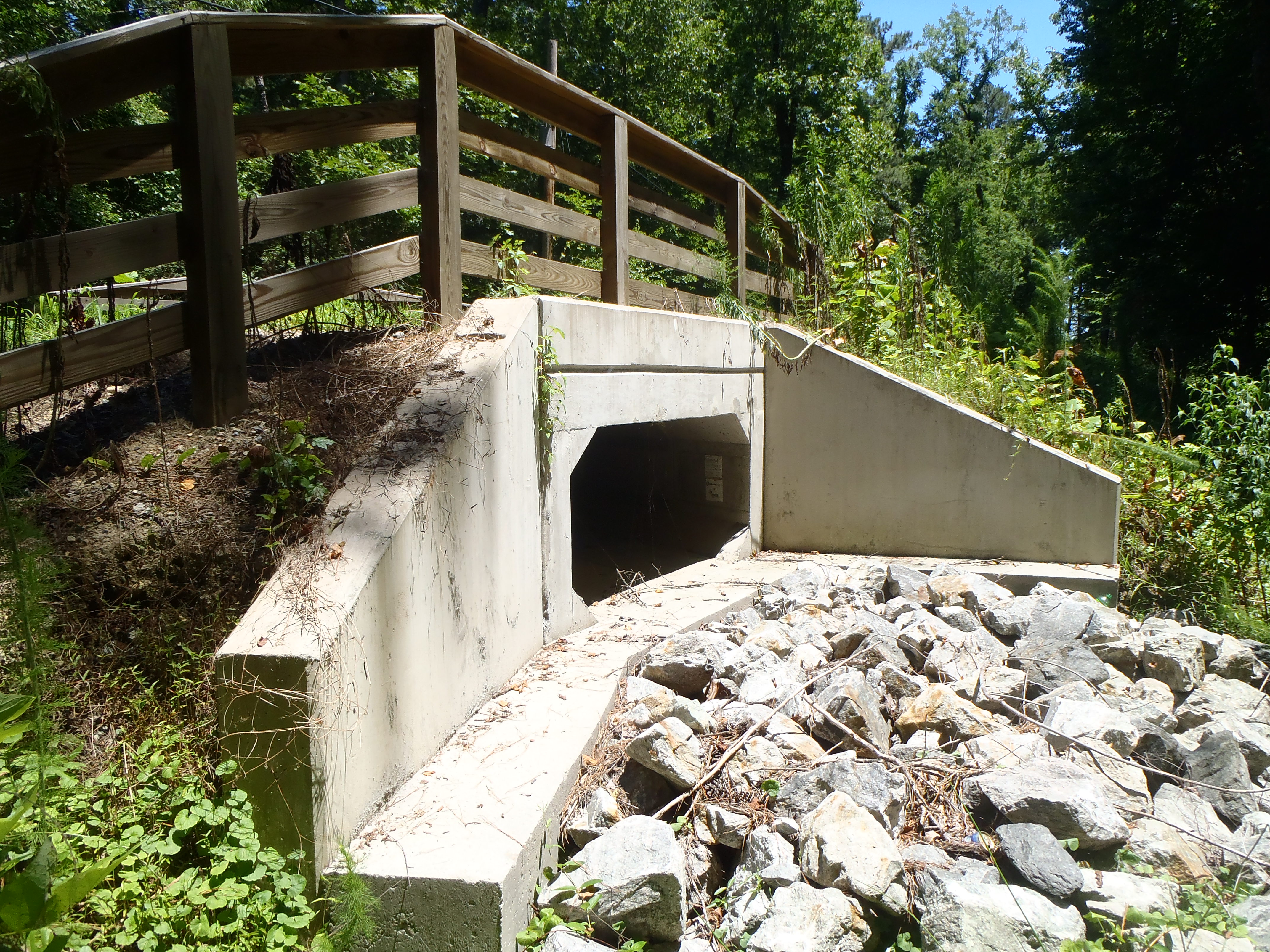
Example of Box Culvert
The first case was a development in the Chester, VA area. The approved crossing was a proposed box culvert with six “barrels” 10’ wide and 10’ high. The ultimate outlet for the area crossed a downstream road with a single 6’ x 10’ box culvert under a road that had never been known to overflow. The approved 6x10x10 structure was needed to minimize the backup of water upstream of the crossing. The “backed up” water could not rise more than 1 foot onto existing lots. With the OK of the Chesterfield Environmental Engineering Department, we looked at alternative methods of sizing the crossing in order to see if we could reduce the cost of the structure while maintaining or reducing the impact upstream. The result of our efforts and approval by the county was a reduction from a six barrel 10’x10’ box culvert to a three barrel 10’x12’ structure. The savings to the developer was over $500,000.
At another site in Chesterfield there was a similar situation in most every way. The water back-up due to the new stream crossing was limited by existing upstream property. The original approved design was a triple box culvert, each barrel being six feet wide by ten feet high. The final design, currently under final review by Chesterfield County, is a triple six foot diameter concrete pipe, resulting in a savings of almost $200,000.
While we strive to design the most economical options that are acceptable to the approving authorities and are safe for the public, certain conditions or regulations may impact solutions. There may be additional access points or different upstream conditions. We make every effort to discover any option available that can save tens or hundreds of thousands of dollars for our clients while maintaining a safe environment for the landowners.
If you would like more information on this topic please contact Matt Faris at 804-200-1935 or by email.

