

30 May 2018 Is One Survey Method Better Than Another?
A Comparison of Conventional Surveying, Photogrammetry, and LIDAR
There are different ways that the elevation and horizontal locations of land are measured. When procuring design data it is important to consider factors that will determine which method is better than another. A brief description of each method is explained below along with the respective pros and cons.
Conventional surveying
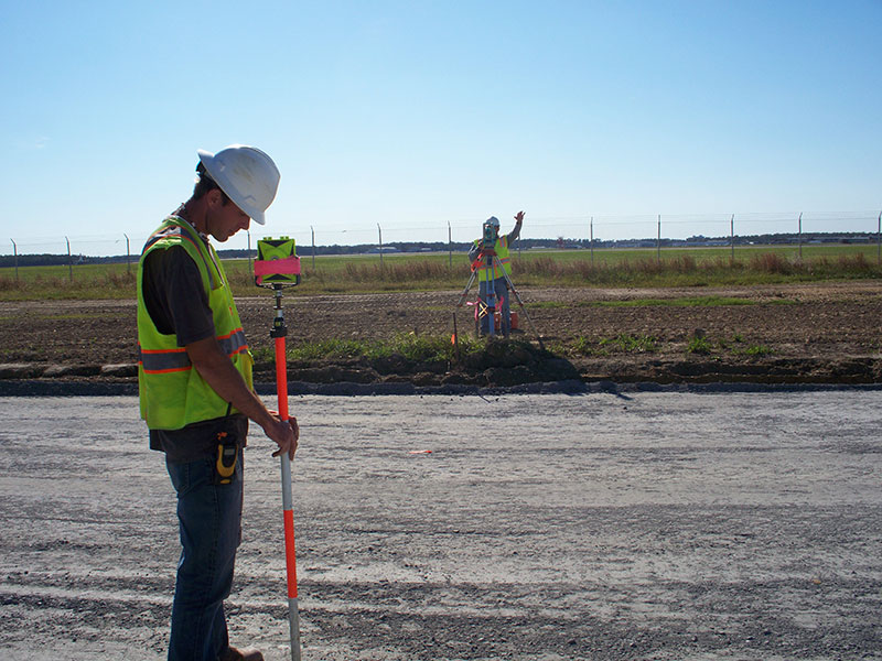
Conventional surveying of land topography is performed by survey crews using a theodolite or level to make measurements. These are the surveyors you see working diligently along the side of the road or at construction sites. Conventional surveying would be used when visual confirmation is desired or when the size of the site makes photogrammetric or LIDAR too expensive.
The advantages of conventional surveying include:
- A visual inspection of the area
- Proven methods of verifying accuracy
- (In my opinion)The most accurate way to measure elevations of geographic features such as streams or ditches
Disadvantages include:
- Line-of-sight obstacles such as buildings or vegetation
- Labor intensity and costs
- Slower acquisition of data
Photogrammetry
Photogrammetry is typically used on larger land areas and is the method of making measurements using aerial photography. Large panel points, which can be seen from the air, are marked typically using GPS equipment. Flight patterns are mapped out and high resolution cameras mounted on air planes take overlapping pictures of a site. Through the use of computers, a 3 dimensional model is generated depicting the horizontal and vertical changes on the land.
Advantages include:
- Large amounts of data can be obtained quickly
- Reduction in costs per acre due to less physical labor
- Accurate locations of intensely developed property
- Photogrammetric locations of site features
Some disadvantages are:
- Line of sight obstructions (mostly caused by both low and high level vegetation)
- Reductions in accuracy due to vegetation
- Inability to actually see the ground surface along streams and ditches
- Time of year constraints due to vegetation
LIDAR
LIDAR topography is the method of measuring property through the use of Light Detection And Ranging equipment. Topographic LIDAR uses a near-infrared laser to map the land. A GPS receiver is used to record data from the laser to map the topography.
Advantages include:
- The ability to measure through vegetation
- Reduction in labor
- Reduction in time
- Lower costs per acre
Disadvantages can be:
- The loss of small details such as ditch depth
- Some loss of accuracy of hard surfaces such as pavement (may or may not meet design standards)
- The loss of details that are available using conventional or photogrammetric methods
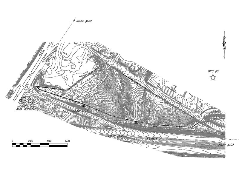
KBJW was fortunate to be involved in the procurement of a topographic survey for a site that consists of over 200 acres. The deciding factors to choose LIDAR as a means to acquire topography were as follows:
- The site was undeveloped and dense vegetation covered the majority of the property
- Starting the project in the spring when foliage on the ground is greater
- The costs of conventionally surveying such a large piece of land.
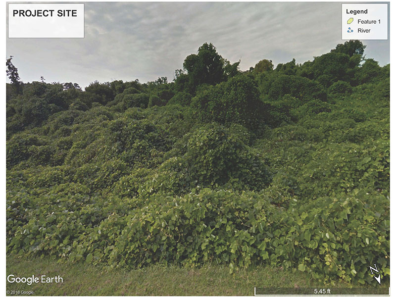
Our firm was experienced in providing conventional and photogrammetric surveys, but had less experience using LIDAR. We had used LIDAR twenty years ago with minimal success. We were apprehensive to use the data without making field checks to confirm the validity of the data and our client agreed that further investigation was warranted. Approximately eleven acres of land totally vegetated by Kudzu was identified as the first area being developed. After the site was surveyed with LIDAR, a contractor was hired to mulch all of the existing plant growth; leaving a wide open site perfect for conventional survey methods to verify the LIDAR topography. We identified a traverse line across the property as well as two drainage systems to check.
The results of the field verification were impressive:
- The majority of the LIDAR data was well within survey design tolerance
- The costs savings were significant
- The completion time was significantly faster.
However, we found that the LIDAR did not generate topography accurate enough for site design along the stream channel bottoms. Stromwater outfalls would need to be field verified. We found that hard surfaces such as curb and gutter or pavement elevations differed up to one and a half inches from our field checks. Tie-ins to existing roads would also need to be field checked prior to final design. And lastly, we had not requested photogrammetric improvements such as asphalt, buildings, curbs, etc. to be located.
We came to the conclusion that LIDAR is a great tool for the development community when master planning and preparing site plans for large sites. A combination of LIDAR topography and photogrammetric topography combined with conventional survey data in specific areas met our requirements as professionals and costs were significantly reduced. The size of the site can affect the economics of surveying methods, but for a large project the value of LIDAR is significant. The needs of our clients differ as much as the lay of the land. KBJW is happy to help our clients bring their visions to fruition through sound design principles with the use of innovation and technology. If you have a site that you wish to discuss or have any surveying questions, please give us a call to develop a plan that best fits your needs.